|
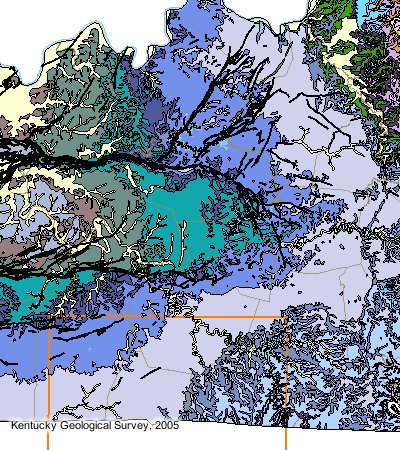
The Rough Creek Fault System is the eastern most extension and terminus of the giant New Madrid Fault System, which begins in Arkansas and spans some 450 miles before wrenching southward and terminating in western Kentucky.
The Rough Creek Fault System is a surface-to-basement fault complex that extends through as much as 30,000 feet of sedimentary rock to the Precambrian formation - earth's original surface before sedimentation began.
The Rough Creek Fault System is a Tectonic System, which means the faulting extends to the earth's tectonic plates, similar to the more widely known San Andreas Fault on the Pacific Coast.
The same mechanical stresses that caused the major fault complex are also responsible for numerous extensions faults off of the main system and extensive "fault related fracturing" in areas near the fault system.
As it relates to commercial Shale gas production, faults can provide "trapping mechanisms" and fractures provide "essential permeability pathways" that allow gas (and oil and water) to move around inside the reservoir.
Understanding the location, orientation and intensity of local faults and fractures systems is an essential science in commercial Shale gas production. | 
